We didn't make the summit. That's where this story ends, so I'll start there. We turned back a stone's throw from Brienzer Rothorn because the final ridge was buried in snow and, with a dog and without ice axes, going on would have been reckless. We were close. We turned around anyway. In the mountains, the willingness to renounce is part of the skill set, and getting that call right matters more than any summit.
This is the Hardergrat, also called the Brienzergrat: a long, knife-edge ridge above Lake Brienz, one of the most exposed hikes in Switzerland. It is not a casual outing, and it is not for every dog. Here's how the two days went with my husky Noushka, and everything you need to weigh before you consider it yourself.
Where this is
When Zürich turns into a furnace in summer, you start looking outward. The Hardergrat sits above Lake Brienz in the Berner Oberland, in Canton Bern, about two hours from Zürich. The ridge runs roughly from Interlaken (Harder Kulm) eastward to the Brienzer Rothorn (2350 m), which is a tripoint where Bern, Lucerne, and Obwalden meet, and the highest point of Canton Lucerne. Sörenberg, where we eventually came down, is in Canton Lucerne.
What applies here is federal law on the protected areas this ridge runs through, and that shaped the whole trip. More on that below.
Day one: a swim, then up to camp
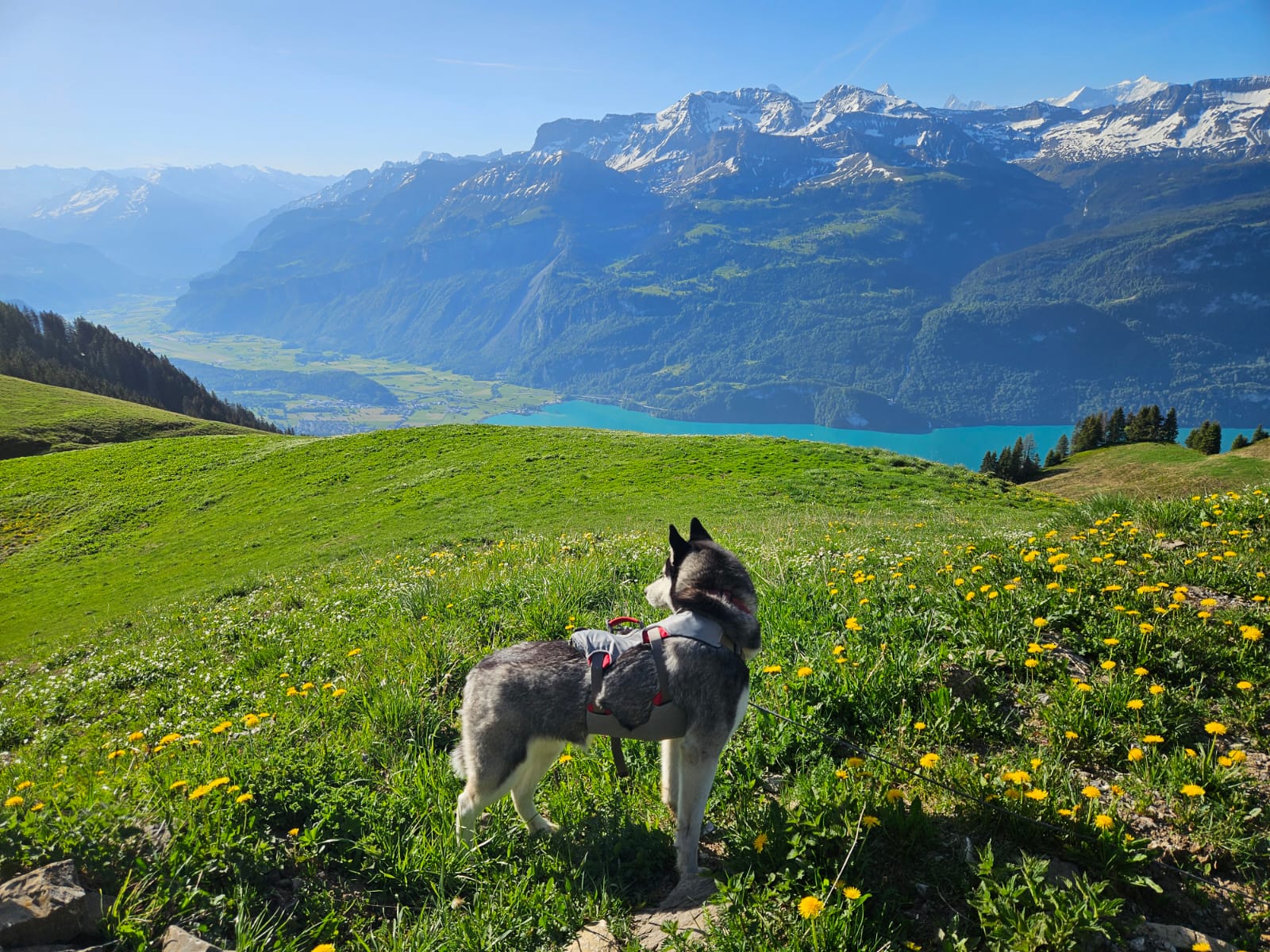
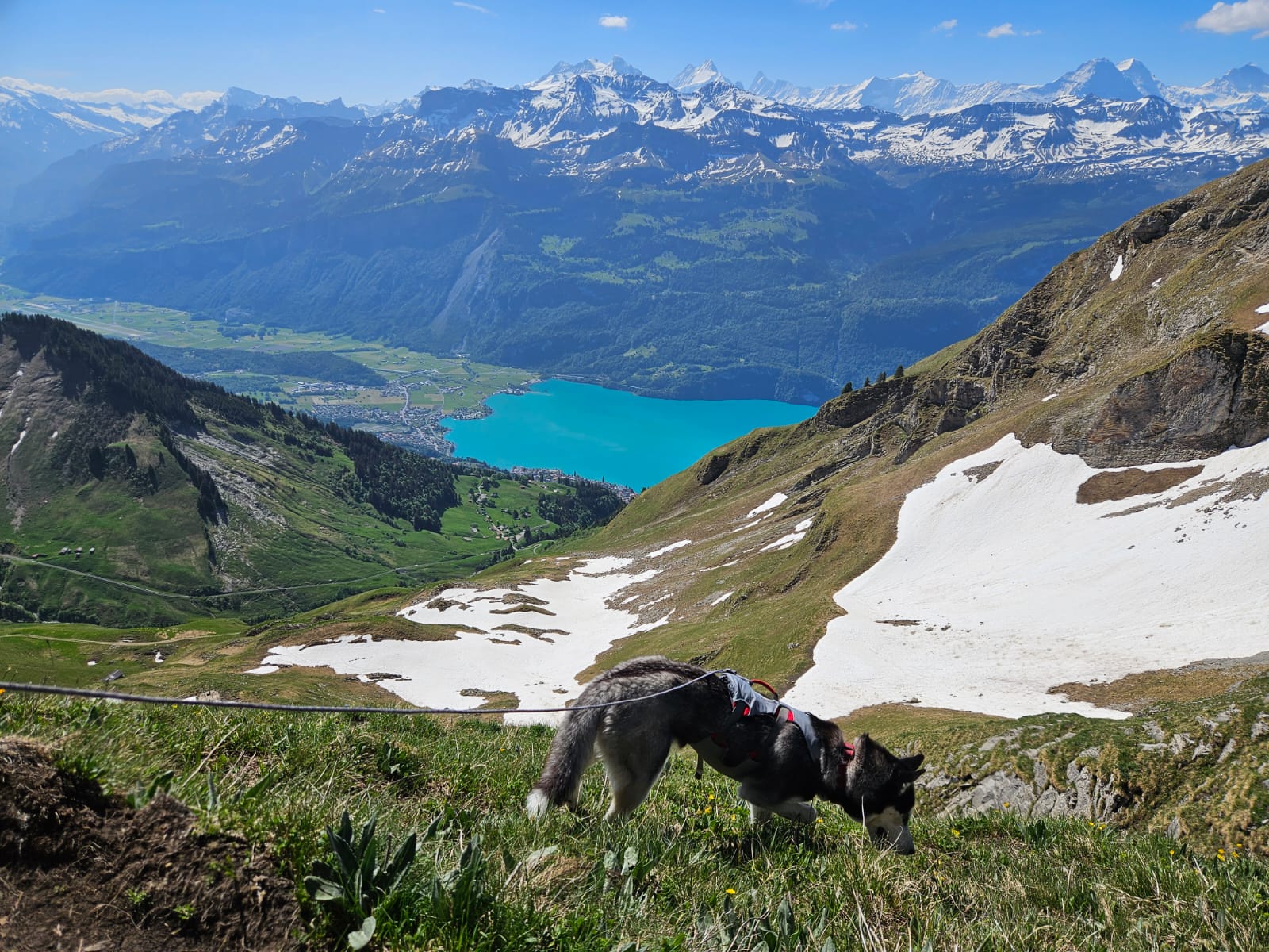
We arrived in Brienz in the afternoon and did the sensible thing first: a swim in the lake. Lake Brienz is that unreal turquoise, cold and clear, and after a drive it resets everyone, dog included. Then we shouldered the packs and started climbing.
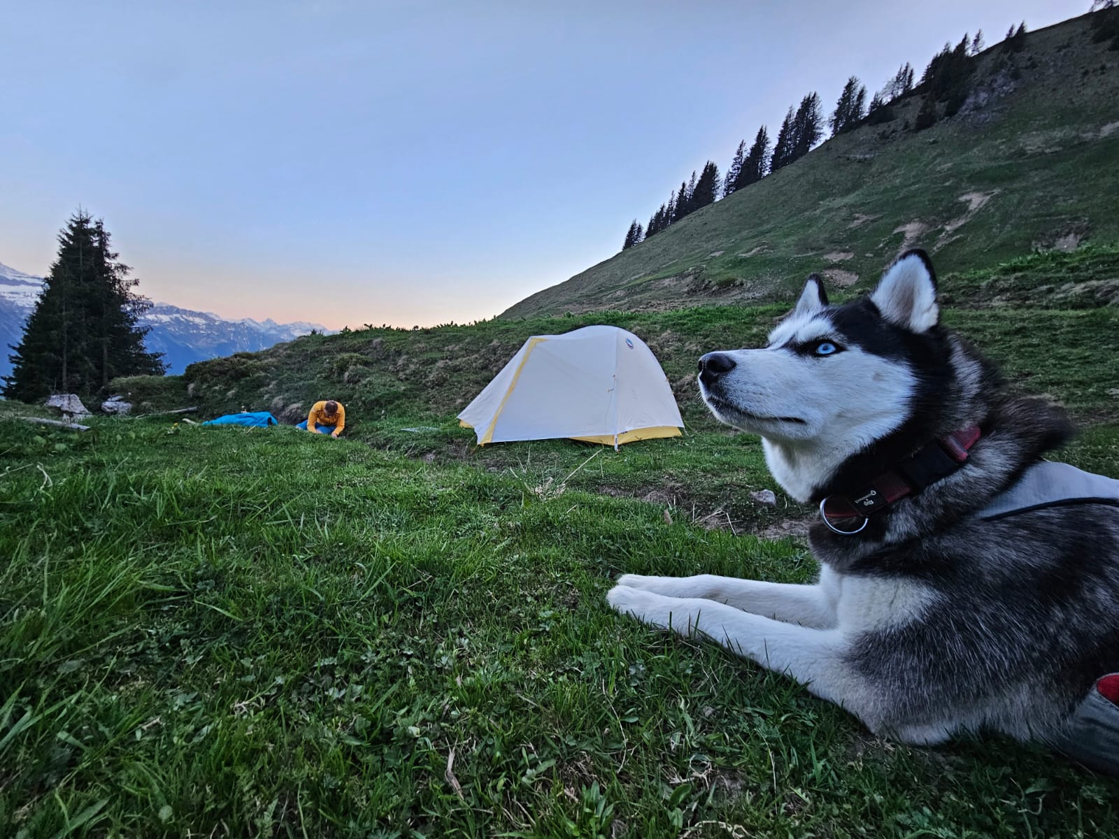
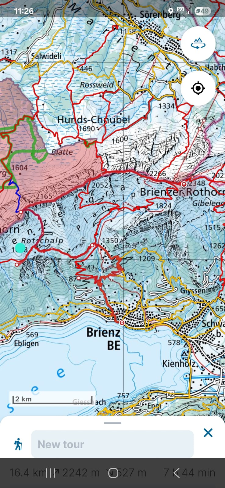
The plan was to camp high, above the treeline, somewhere around Rotschalp on the south flank below the ridge, then traverse toward Brienzer Rothorn the next morning and take the railway down from the summit. We climbed up out of the trees into open alpine slopes and pitched the tent with the ridge above us and the lake far below.
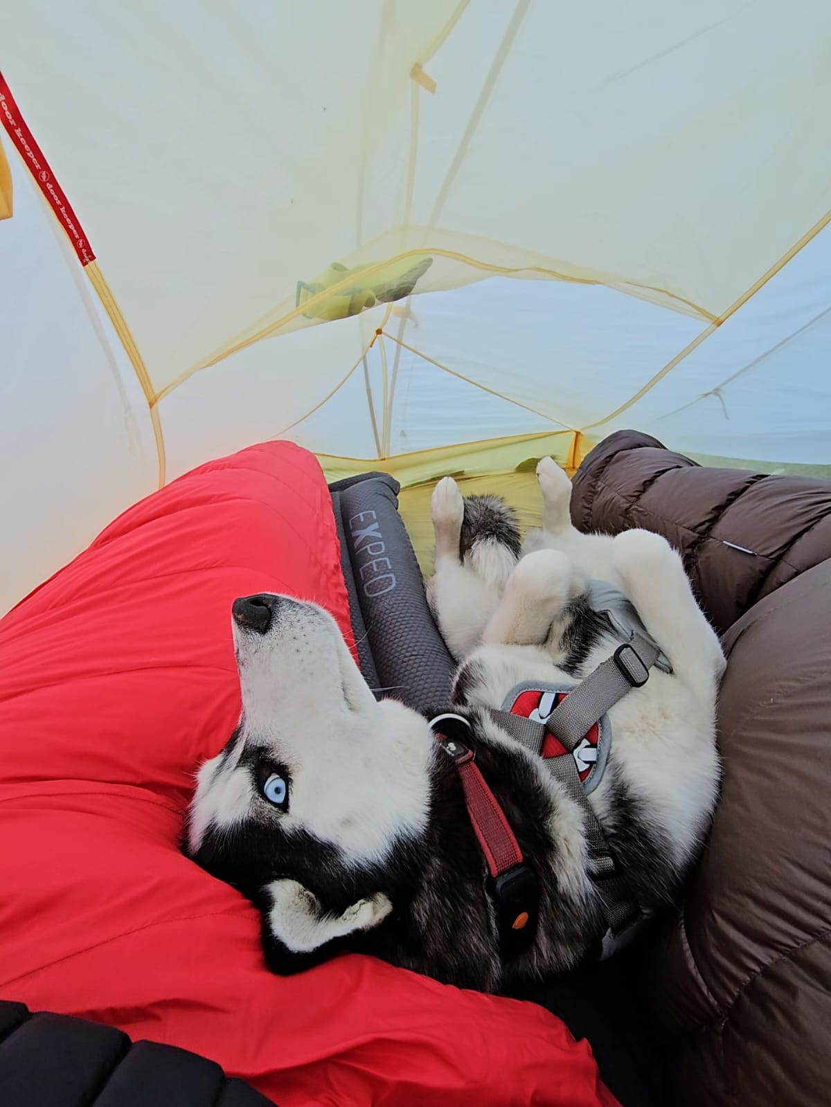
Noushka is a husky. She could sleep outside in a snowstorm and be perfectly happy. But she loves being in the tent with us, and we love it too (at least one of us does, and it isn't always the one doing the cooking). So she slept in.
What we could see from camp was the reason to keep a dog close up here: chamois and ibex, lots of them, moving along the slopes in the evening light. Watching them from a distance is the highlight. Having a dog bolt toward them is the nightmare. Which brings me to the leash.
On the leash the entire time, and why
Noushka did the whole hike on the leash. Start to finish, no exceptions. Two reasons, and both are non-negotiable here.
First, the law. The ridge runs through federal game reserves (eidgenössische Jagdbanngebiete): the Augstmatthorn reserve on the Bern side and the Tannhorn reserve on the Lucerne side. Under federal law on these reserves, dogs must be kept on a leash, full stop. Wildlife may not be disturbed, fed, or chased.
Second, she's a husky. High prey drive is bred into the dog. Put a high-prey-drive dog next to a colony of ibex and chamois on exposed terrain and an off-leash mistake becomes a danger to the wildlife, to the dog, and to you. For a dog like this, off-leash here is simply never an option, not even "just for a second" on what looks like an easy stretch.
A loose dog on a ridge with 1500-metre drops is a horror story waiting to happen regardless of the law. So the leash stayed on, the whole way. For the night, a ground anchor kept her secured by the tent so she couldn't wander toward the slopes in the dark. For more on why leash rules matter most in wildlife areas, see our piece on the dog leash law in Zürich and Switzerland.
Wild camping: not a right, and forbidden here
Here's the part too many people skip. Switzerland has no general right to wild camping. The Swiss Alpine Club's position is that a single-night bivouac above the treeline is tolerated if you behave responsibly. Tolerated is not the same as allowed. And inside federal game reserves, free camping is explicitly forbidden to protect the wildlife.
The Hardergrat runs through exactly such reserves. Rotschalp, where we camped, sits at or very near the edge of the reserve boundary. I'm not going to pretend our exact spot was outside it, because I can't verify that to the metre, and that's the honest position to take. So treat this as a cautionary report, not a recommendation to camp where we did.
If you are weighing a night up here:
- Check the protected-area boundaries first. The federal game reserves and wildlife rest zones are shown on map.geo.admin.ch (look for the "Eidg. Jagdbanngebiete" and "Wildruhezonen" layers). The shaded zones are where camping is forbidden.
- Default to not camping inside the reserve. If your spot is inside the boundary, or you can't tell, don't pitch there.
- Pitch late, strike early. Tent up just before dark, gone again at first light. A bivouac is one night, not a base camp.
- Leave no trace. Everything goes back down with you. No fires, no rubbish, no scraps, nothing left behind.
The Swiss Alpine Club's official rules on camping and bivouacking are here (in German).
Day two: an early start to beat the heat
It was a hot day in May, which sounds like a contradiction until you've sweated up an exposed ridge in full sun. We struck the tent early, packed everything, left no trace, and set off in the cool of the morning toward the Wannenpass on the ridge.
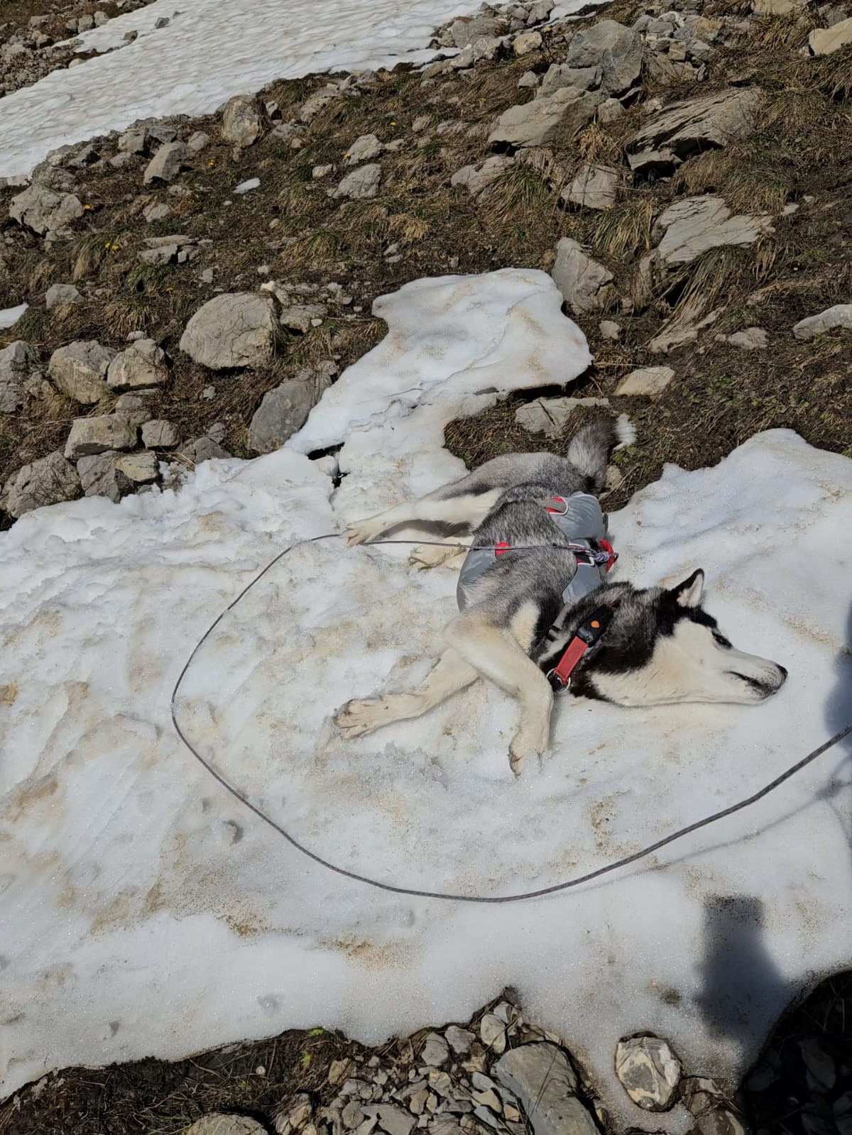
This is where the terrain gets serious. We followed the blue trail, the alpine route, which is steep and, in May, streaked with névé (hard old snowpack) on the shaded sections. You have to be sure-footed. I used micro-crampons on the snow patches, which I'd packed precisely because I expected early-season snow. They aren't required gear in any official sense, but on hard May névé they turned sketchy steps into solid ones. That's an experience-based recommendation, not a rule.
The ridge: what it actually is
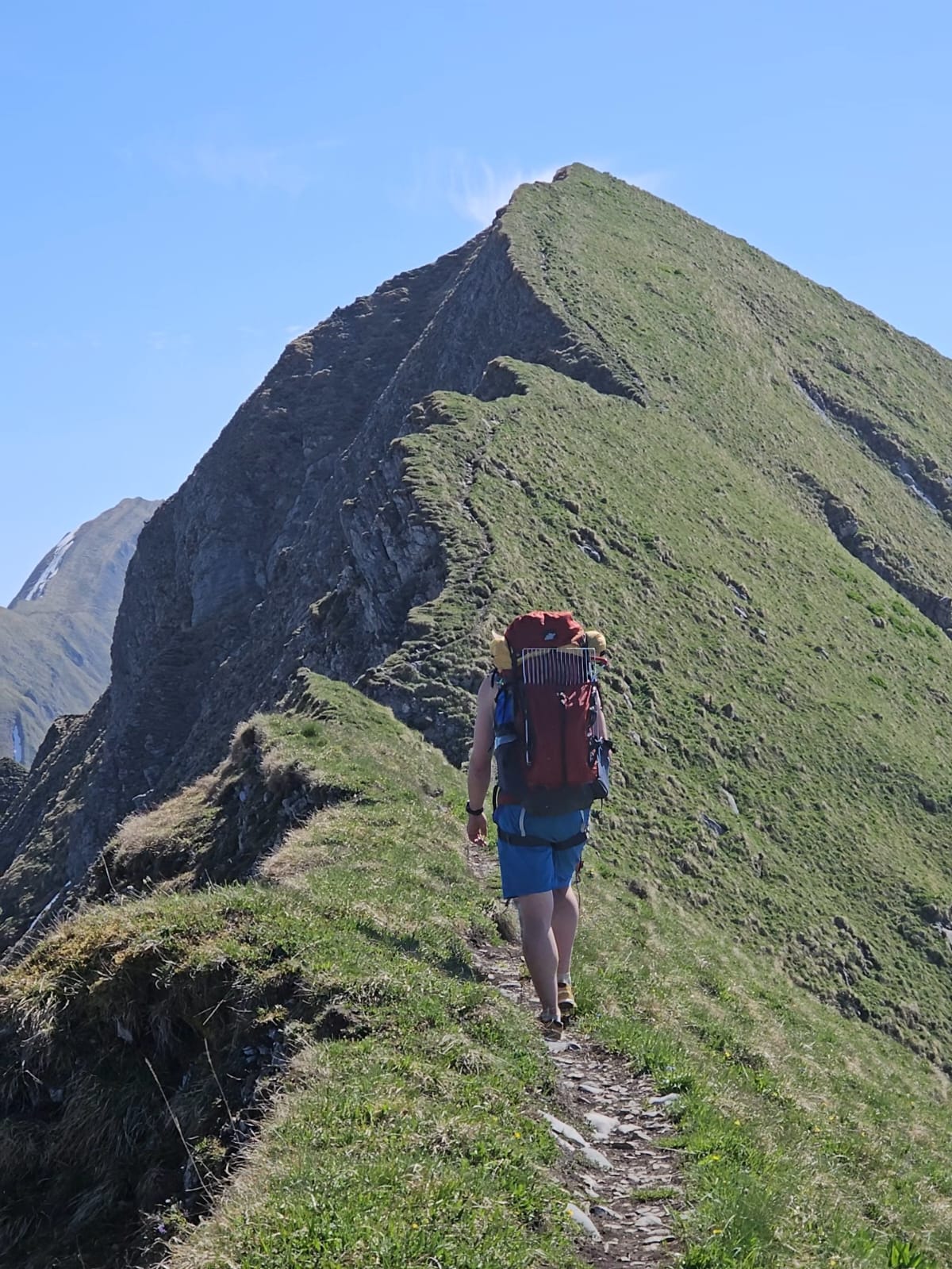
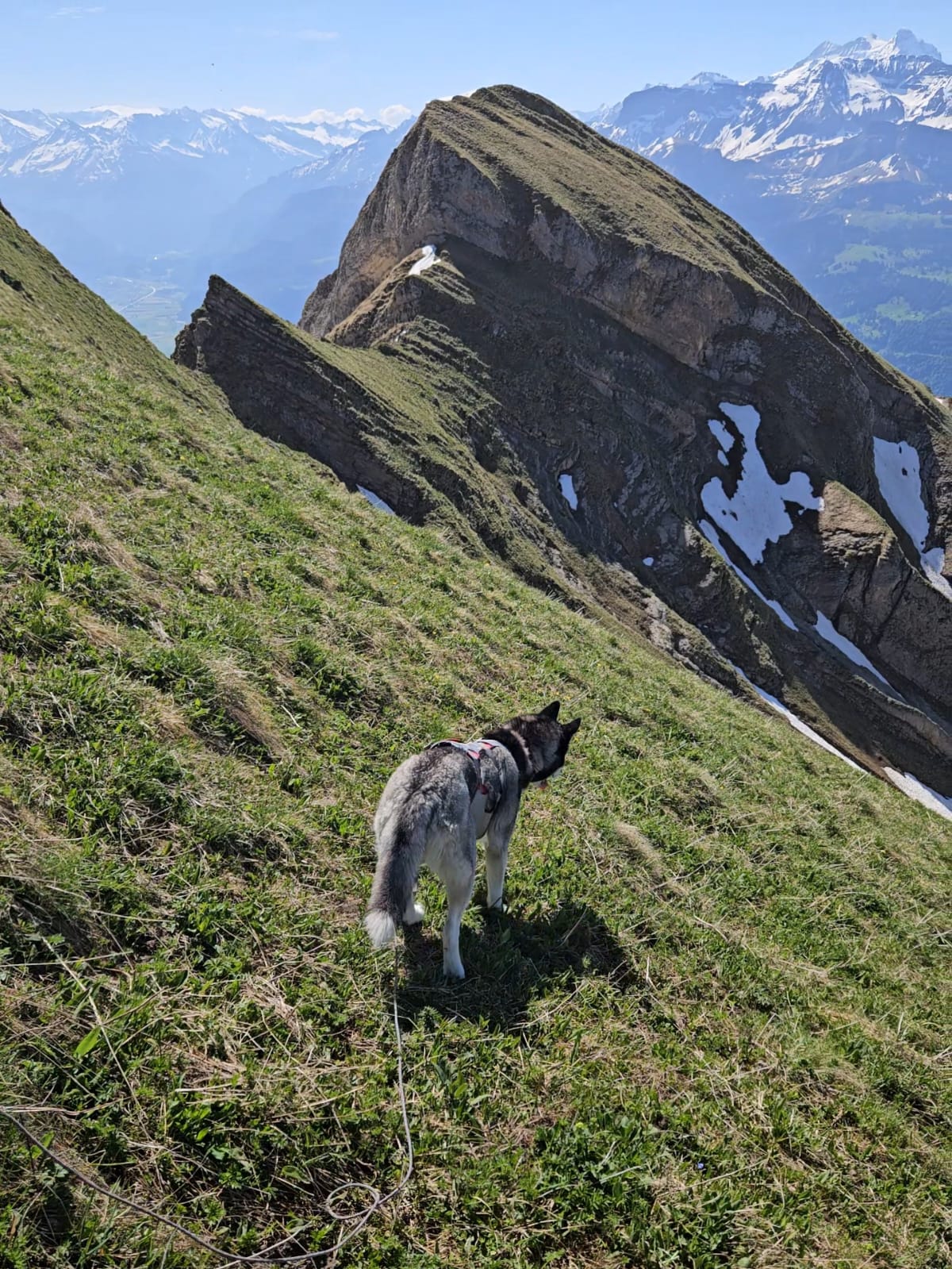
Once you're on the crest, the Hardergrat is a grassy knife-edge with big drops on both sides. The ground falls away as much as 1500 metres in places. On the SAC hiking scale, the route is T3 to T4 for most of its length, with a short T5 passage after the Tannhorn where you sometimes use your hands. It is widely described as one of the most exposed ridge walks in the country, and that reputation is earned.
What that means in practice:
- Sure-footedness is essential, for you and the dog. A stumble in the wrong spot has serious consequences. If exposure makes you uneasy, turn around early.
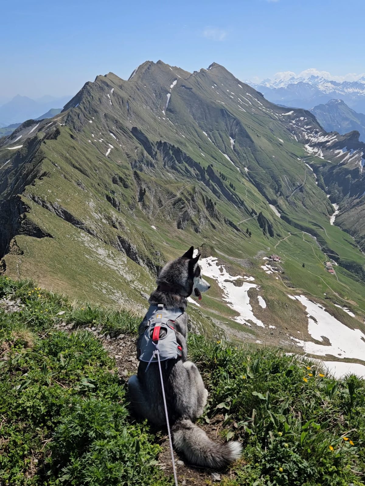
- Your dog has to be steady on narrow, exposed ground and physically fit. Noushka walked the whole ridge herself. She's a goat. But not every dog reads exposure calmly, and a panicking dog on a knife-edge is dangerous for both of you. Be brutally honest about your dog before you commit.
- There are several ways to do this hike. The classic full traverse runs Interlaken / Harder Kulm to Brienzer Rothorn (around 20 km, some 3000 metres of climbing, a very long day or split with a bivouac). Shorter options exist too: single summits like the Augstmatthorn, or our approach climbing up from Brienz to join the ridge. Pick the variant that matches your fitness and your dog's, not the one with the best photos.
No water. None. For the whole ridge
This is not a footnote, it's a defining hazard. There is no water source anywhere along the Hardergrat, from one end to the other. You carry everything you and the dog will drink.
In summer heat, plan on 3 to 5 litres per person, plus extra for the dog. Dogs regulate heat far worse than we do, and on a sun-exposed ridge their need climbs fast. A rough guide is around 80 to 100 millilitres per kilogram of body weight per day in the heat, so a 30 kg dog needs a good 3 litres, and all of it rides up in your pack. Offer water before the dog is panting hard. If it's already panting heavily, you waited too long.
The turn-back
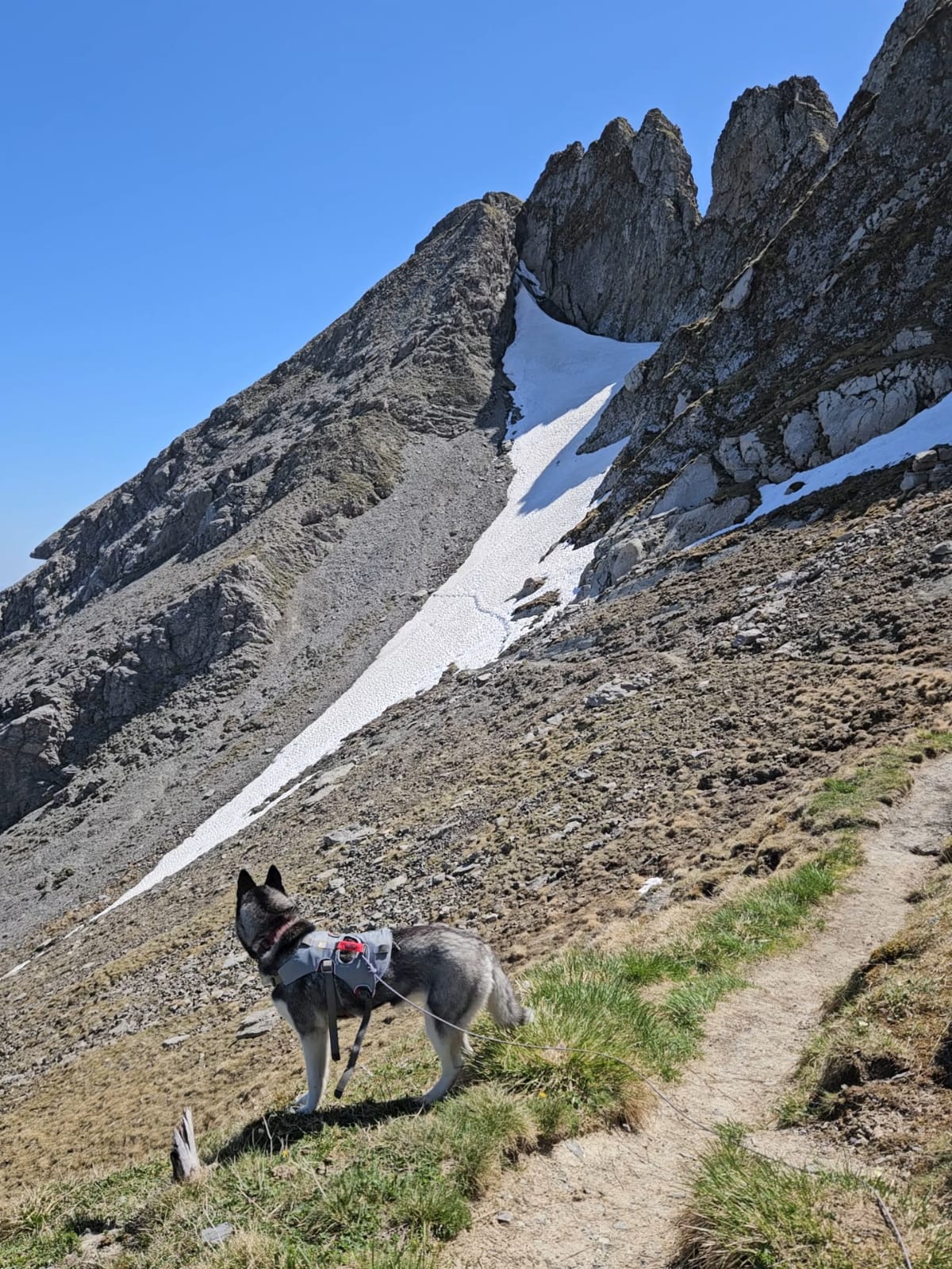
The plan was to reach Brienzer Rothorn and ride the historic cog railway down. We followed the ridge toward the summit, and then we hit it: the final stretch before Brienzer Rothorn was still deep in snow. Not soft spring snow you can kick steps into, but hard, steep névé where a slip wouldn't stop. Without an ice axe, and with a dog, going on would have been gambling with all three of us.
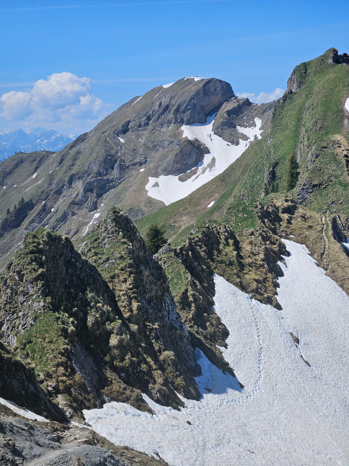
So we stopped. We stood there, summit in sight, and made the call to turn around. It stings every time. But the mountains will be there next year, and the whole point of being experienced is knowing where your line is and not crossing it because you're close.
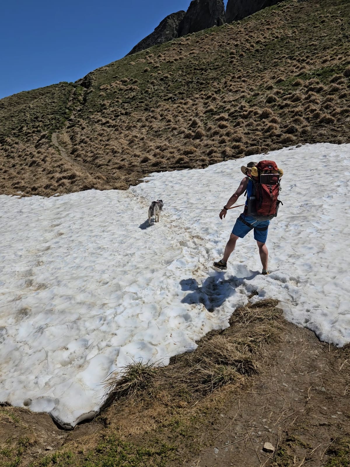
We retraced our steps and took the red trail down to Sörenberg in Canton Lucerne, then caught a PostBus connecting to a train to Lucerne. Long way round, but every step of it was the right decision.
Getting down: the transport options
If you do complete the traverse to Brienzer Rothorn, you have two civilised ways down instead of walking:
- Brienz Rothorn Bahn, the historic cog steam railway from the summit down to Brienz. Dogs are allowed, around CHF 10 per dog. You buy the dog ticket at the Brienz ticket office (not online), no seat reservation needed, and you sit away from the locomotive because of the noise and steam. The 2026 summit service runs 6 June to 25 October.
- Sörenberg cable car on the Lucerne side, which also takes dogs (dogs must be leashed in the area). I won't quote a summer dog fare or exact dates because I couldn't verify them, so check the official Sörenberg cableways page before you plan around it.
We took neither, because we turned back. On foot to Sörenberg, then PostBus and train to Lucerne. It works.
What we carried
Beyond the standard hiking-with-a-dog kit, an exposed ridge with a high camp and early-season snow calls for a few specific things. If you're still building your basic setup, start with our hiking with a dog in Zürich guide.
What rode in our packs:
- Water, all of it. No source on the ridge means you carry every litre. A collapsible bottle lets the dog drink on the move.
- A leash, used the whole way. Federal game-reserve rule and basic sense on exposed ground.
- A ground anchor for the camp, to keep the dog secured near the tent overnight in this wildlife-rich area.
- Micro-crampons for the early-season névé. My call based on the conditions we expected, not a hard requirement.
- A first aid kit for dog and human.
- A tick remover. A must in Switzerland, where tick season runs spring into autumn.
- A dog climbing or belay harness. This is contingency kit: a proper harness lets you lower or belay the dog over a short steep step if you ever had to. We carried one and never needed it, because Noushka walked every metre herself. But on terrain like this, having the option is reassuring.
- A dog rescue or carry harness. The other contingency: a sling to carry an injured dog out. You hope to never open it. You carry it anyway.
Here's the specific gear we use or recommend:
Take the free quiz and get your personal compliance plan with exact deadlines.
Start the quiz →Would we do it again?
Yes. In late June or September, with the snow gone, we'll come back and finish the ridge to Brienzer Rothorn. The turn-back wasn't a failure, it was the trip working exactly as it should. We read the conditions, weighed the dog and the terrain, and chose the option that got all three of us home.
If you want our other honest alpine trip reports with a dog, the Stockflue T5 hike in Canton Schwyz is a harder route where Noushka hit her limit, and the bivouac at the Klimsenhorn on Mount Pilatus is a gentler night out with the same wildlife and camping ethic. For something altogether easier, our Klöntalersee day is the relaxed end of the outdoor spectrum.
Useful links:
- map.geo.admin.ch (check the game reserve and wildlife zone layers before you go)
- Brienz Rothorn Bahn dog policy
- Brienz Rothorn Bahn 2026 timetable and prices
- Sörenberg mountain cableways
- SAC: camping and bivouacking
This article contains affiliate links. If you make a purchase, Züri Paw Society earns a small commission at no extra cost to you.
This is a personal trip report, not professional mountaineering advice. The Hardergrat is in Canton Bern (with the descent into Canton Lucerne), and dog-specific rules differ from canton to canton. The route is genuinely serious terrain. Assess your own dog's fitness and the current conditions honestly before setting out, and turn back when it isn't safe. Every trip is undertaken at your own risk.